[deck]Though unmanned aerial vehicles (UAVs) are just beginning to buzz over Canadian crop fields, experts agree these new ‘eyes in the sky’ are about to fundamentally change how potato farmers see, interact with and manage their crops.[/deck]
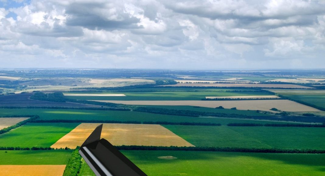
Agriculture is on the cusp of a game-changing leap forward in technology. Currently, most agricultural unmanned aerial vehicles (UAVs) are used for the technologically simple task of remote digital photography
But, government and private-sector scientists alike are proving UAVs can do much, much more for Canadian farming.
“Soon, definitely less than a decade from now, using UAVs will be a common-place practice; just one more tool in the toolbox,” says Dan Clarke, executive vice president of business development and agronomy with A&L Canada Laboratories, a company currently commercializing high tech UAVs for agricultural applications.
“One of the main limiting factors for UAVs right now is understanding the data that gets collected so that you can use that data to make good management decisions. That’s where we are going now.”
Every farmer knows that an enormous variety of factors, from microorganisms to soil composition to disease and pest presence, can influence crop yields. In order to optimize returns, farmers of the future will need to apply targeted, variable rates of crop inputs, especially in high-value crops like potatoes. The challenge, of course, will be determining what needs to go where.
For the past four years, Agriculture and Agri-Food Canada (AAFC) researchers Anne Smith and Bernie Zebarth, with support from Potatoes New Brunswick and McCain Foods (Canada), have worked to build yield maps of potato fields in New Brunswick. Using increasingly high tech UAVs, cameras and light sensors, the two are attempting to create functional algorithms that can be used to map spatial variability of potato yield. These maps are intended to identify parts of the field that need to be managed differently, or problem spots that require intervention to solve yield limitations.
The idea is not entirely new. For several decades, scientists, crop consultants and even some tech-savvy farmers have attempted to use satellite imagery to determine in-field variability. However, two major factors hamper satellite photographs’ utility in agricultural application. First, satellites only fly over specific locations every so often. Because cloud cover – particularly in notoriously cloudy maritime locations like New Brunswick – block the satellites’ view, getting useful images during infrequent flyovers can be incredibly challenging. Secondly, when clouds finally part and satellites manage to capture images of target areas, the images are unsatisfyingly coarse. Satellites’ zoom generally maxes out at a plot of about 30 by 30 square metres, making fine detail like in-field foliage variation very difficult to identify.
Enter UAVs. Smith and Zebarth started out using a simple drone and regular digital camera. In ideal weather and at optimal sunlight angles, this basic technology is relatively effective. However, the researchers’ priority was for their findings to be transferable to real-world commercial application, which rarely has the luxury of perfect operating conditions. And, rather than general, scouting-level approximations, they wanted hard results: quantifiable, numerical, comparable findings that farmers can build input prescriptions upon.
So, two years ago, they moved to higher-tech digital cameras with remote upward and downward looking light sensors.
“When we fly a field, we get 60 or 70 images that we have to stitch together. If cloud cover is patchy, you’ll get some parts of images that are dark and some that are light, which can skew the numbers in your results,” explains Smith.
“If what you’re looking for is some kind of qualitative estimate, a regular digital camera isn’t so bad. But, if you’re looking for really quantitative results, you need to be able to determine the amount of solar radiation hitting the target compared to what comes back to the sensor (reflected from the ground), because then it doesn’t matter if there’s inconsistent cloud cover or not. That way, you can take photos over time and your numbers from day one to day two actually relate to each other.”
The results using this better technology are very positive so far.
“We’ve done biophysical sampling in the fields we’ve flown and we’ve found a very good relationship between our remote results and the actual biomass and plant nitrogen levels,” she says. “We’re then able to create biomass zones that give a very clear comparison of spatial variability and biomass parameters. Our goal, and we’re achieving that goal, is to get results that are quantitative rather than just nice pictures.”
Smith hopes this year’s results, as well as the study’s final results next year, will reinforce and complement findings from the previous four years. Ideally, the findings will excite and inspire funders to extend the study, she adds, since the potential for this technology is endless.
Meanwhile, researchers at A&L Canada Laboratories in London, Ont., are building algorithms that go a big step beyond remote yield analysis. Their UAV-powered technology is designed not only to find yield decreases, but to conclusively determine what disease or deficiency is causing that loss.
“When diseases or deficiencies affect a plant, physiological changes within the plant cause the leaves to reflect light differently than a healthy plant does. Each disease and deficiency has a different light ‘signature’, not in the normal RGB (red, green, blue spectrum) we’d see with our eyes, but in multispectral or hyperspectral light. So, when you see that wavelength in your crop, you have a very clear indicator that you have that disease or deficiency,” explains Clarke.
Though some might think this level of remote assessment sounds like futuristic science fiction, Clarke assures the technology is very here-and-now.
“We started with late blight in potatoes and we are very close to being able to clearly identify that disease from leaves’ reflected light. I’d almost say it is commercializable today,” he says.
“Obviously, it is a lot of research and money to identify every nutrient and every disease in a crop. So, it is just a matter of how quickly can we bring all this technology to the marketplace. It will take a few years to get a crop like potatoes fully mapped, but we are getting there.”
Equally interestingly, he says the price tag should be accessible to virtually all farmers.
“This will be very affordable. Depending on acreage, it will be cost effective for some producers to purchase the whole package: hardware, camera and software. Others might want to hire a consultant or an ag retailer. But it’s definitely going to be attainable pricewise.”
Both Smith and Clarke believe agriculture is currently imagining only the very tip of a giant iceberg of potential UAV benefits. But, adds Smith, carefully choosing which research and development avenues to pursue will ultimately determine whether UAVs achieve their potential.
“People love technology so there is lots of interest in UAVs right now,” she says. “But the technology will only last if it provides an answer to a specific question, and that answer needs to save the producer money. I can answer all sorts of questions with remote sensing but if those answers have no economic value, they are of no value to producers. We need to keep asking what producers want to know. The technology has the capacity to come up with answers. We just have to keep making sure we focus on the right questions.”