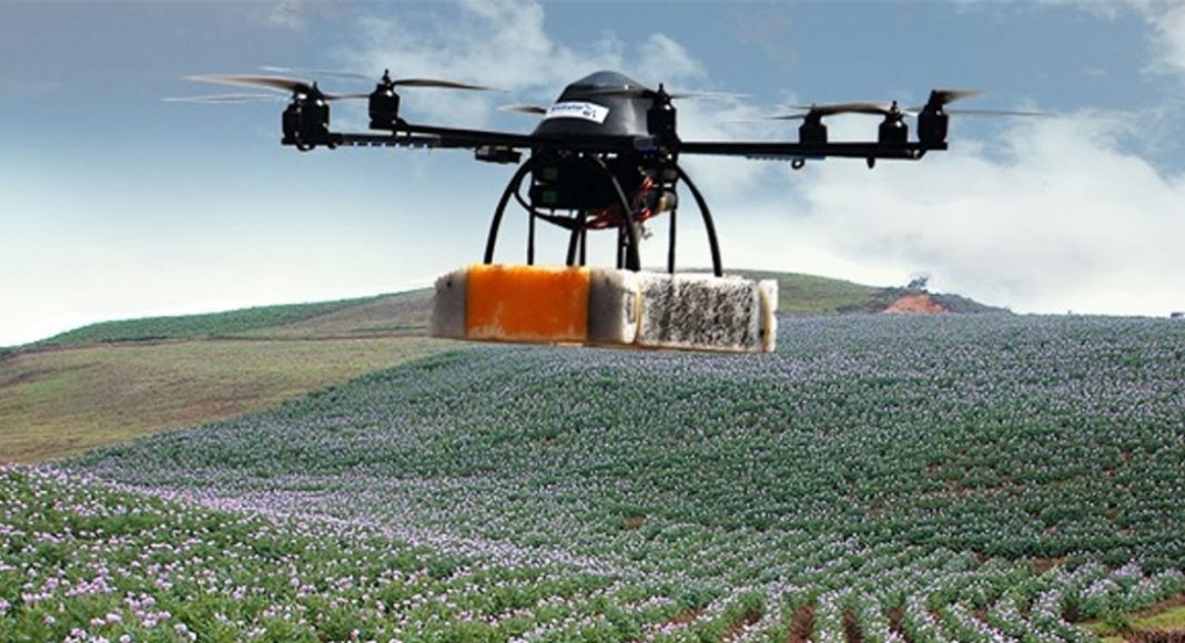
The traditional image of a farmer standing in a field, squinting anxiously at the sky for signs of rain, may be about to get a 21st-century makeover as researchers explore the use of drones on farms from Sri Lanka to Uganda.
The ability of unmanned aerial vehicles (UAVs or drones) to hover low over fields of maize, sweet potato and rice with sensoring devices promises benefits for individual farmers and their communities.
For governments and development agencies, drones can provide more accurate, up-to-date information on what is being grown where. For individual farmers, this kind of information could be the difference between a failed crop and a bumper harvest.
In September, the International Water Management Institute (IWMI) carried out trials in Sri Lanka using an eBee drone equipped with a near-infrared sensor; the trials showed how this can give farmers early warning of problems anywhere in their fields.
“Using near-infrared, you can identify stress in a plant 10 days before it becomes visible to the eye,” says Salman Siddiqui, head of IWMI’s GIS remote sensing and data unit.
“When a plant goes into stress, it’s either due to a water or fertilizer shortage, or because it’s being attacked by a pest. Photosynthetic activity decreases and that affects the chlorophyll. That’s what the near-infrared sensor can detect, but our human eye can’t see it until it’s more advanced.”
That 10-day warning could prevent large-scale crop losses. Siddiqui says: “If a crop is being attacked by insects, the whole area can be affected, not just one farmer. With UAVs, if you can figure this out before it spreads, you can save the whole area.”
In Uganda and Tanzania, the International Potato Center (CIP) has been carrying out drone trials in partnership with the national bureau of statistics in both countries.
Accurate data is crucial for effective agricultural policymaking, and a report by the World Bank this year highlighted how patchy that data is for much of sub-Saharan Africa.
According to Dieudonné Harahagazwe, a senior CIP scientist based in Nairobi, this data gap is behind agencies’ eagerness to participate in researching the potential of drones.
“Donors and governments look at statistics, and in some places smallholder plots are so small we don’t have precise statistics on their crops,” he says.
“With sweet potato, for example, policymakers might say it’s not an important crop because there are just small, scattered plots. Or the statistics can’t tell the difference between potato and sweet potato. This is important, because farmers lose out if the statistics are not accurate.”
This was confirmed by CIP’s initial trials using drones to map fields in Uganda. According to its research in the Kumi district of eastern Uganda, official statistics underestimated the planting of sweet potato by a staggering 50 per cent.
Such a disparity between what’s on the books and what’s in the fields can make a crop less visible to policymakers, which means smallholders might not gain access to relevant extension services such as training, seeds or micro-insurance.
Drones are becoming cheaper, but are smallholder farmers in sub-Saharan Africa likely to be launching them over their fields? Probably not yet.
CIP is looking into how people might assemble drones themselves more cheaply with materials that are available locally. The University of Nairobi is collaborating with engineers who are working on the design and construction of their own vehicles with a long-term view to developing an industry in Africa as a more sustainable alternative to importing devices.
In some places, regulatory approval for drones is also still an issue, and the challenge is not just to fly them but to process the data gathered.
In smallholder settings, NGOs and the public sector might start using drones, particularly for plant health, and farmers’ associations could too. “In developing countries, it’s still the case that farmers get together and share tractors, so this could be another area where they pool resources,” says the IWMI’s Siddiqui.
But for the majority of the world’s smallholder farmers, the benefits are likely to remain indirect: with drones informing agricultural policymaking to increase its efficiency, Harahagazwe says.
“If you lack information on specific crops, those crops suffer in terms of technical support, so it’s about how we can influence policymakers about how budgets are allocated to agricultural sectors,” he says.
“The drone itself is like a toy. But it can tell us a lot about crop health, and varieties of crops grown. It can give us true information from small farmers, and with that we can support and advise them accordingly.”
To learn more, visit the guardian.